Understanding Groundwater Flow Beneath the Surface
In karst environments, groundwater rarely follows predictable pathways. Instead, water moves through a complex network of fractures, conduits, sinkholes, and underground caves that can extend for kilometres beneath the surface. Understanding how water travels through these hidden systems is critical for groundwater protection, land-use planning, contamination studies, and sustainable resource management.
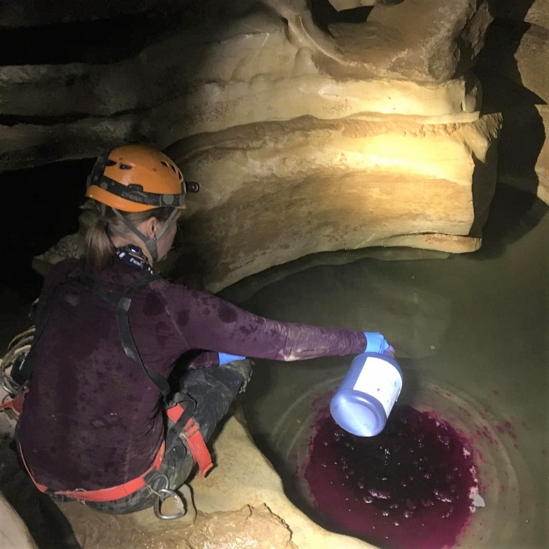
One of the most effective tools available to hydrogeologists for investigating these complex groundwater systems is dye tracing. By combining traditional dye tracing techniques with modern continuous monitoring technology, researchers can now develop highly detailed models of groundwater flow that were previously impossible to achieve.
What is Dye Tracing?
Dye tracing is a technique used to identify groundwater flow paths and determine the connectivity between recharge and discharge points within an aquifer. A fluorescent dye is introduced at a known location, such as a sinkhole, losing stream, borehole, or cave passage, and monitored at springs or other potential discharge points downstream.
As the dye travels through the groundwater system, researchers can determine:
- Groundwater flow direction
- Travel times between locations
- Flow velocities
- Aquifer connectivity
- Storage and dispersion characteristics
- Groundwater basin boundaries
Because many fluorescent dyes can be detected at extremely low concentrations, dye tracing remains one of the most reliable methods for characterising karst aquifers.
The Challenge of Mapping Karst Groundwater Systems
Researchers from Crawford Hydrology Laboratory at Western Kentucky University have been conducting dye tracing studies within the Great Onyx Groundwater Basin in Mammoth Cave National Park, Kentucky.
While extensive dye tracing programmes conducted during the 1970s and 1980s mapped much of the groundwater system within Mammoth Cave National Park, portions of the Great Onyx Basin remained relatively unexplored. To better understand the basin’s groundwater flow network, researchers sought to develop a high-resolution three-dimensional model of the aquifer’s internal flow system.
Traditionally, dye tracing investigations often rely on:
- Charcoal receptor monitoring
- Periodic grab sampling
- Laboratory analysis of collected samples
While effective for establishing groundwater connections, these methods can be labour-intensive and often provide limited temporal resolution.
Researchers needed a solution capable of continuously collecting data while reducing field effort and improving the accuracy of travel-time and dye recovery calculations.
Why Continuous Monitoring Matters
Continuous monitoring offers significant advantages over traditional sampling methods.
Rather than relying on periodic manual samples, sensors record data continuously throughout the duration of a tracing event. This allows researchers to capture the complete dye response as it occurs.
One of the most valuable outputs from continuous monitoring is the breakthrough curve, which plots dye concentration against time.
Breakthrough curves provide insight into:
- Groundwater velocity
- Aquifer storage characteristics
- Dispersion behaviour
- Preferential flow paths
- Dye mass recovery
Peak concentrations can occur between manual sampling events and may be completely missed using traditional methods. Continuous monitoring ensures that these critical data points are captured, improving confidence in the final interpretation.
Using the Aqua TROLL 600 for Quantitative Dye Tracing
To obtain the high-resolution data required for the study, researchers deployed an In-Situ Aqua TROLL 600 Multiparameter Sonde at Great Onyx Spring, a known resurgence point within the basin.
The system was equipped with sensors measuring:
- pH
- Specific conductivity
- Temperature
- Water level and pressure
- Fluorescein concentration
- Rhodamine WT concentration
Fluorescent dyes were introduced at selected locations within the cave system while the sonde continuously monitored conditions at the spring.
The resulting dataset allowed researchers to accurately track dye arrival times, determine travel pathways, and analyse breakthrough characteristics with far greater precision than would have been possible using manual sampling alone.
Field operations were further simplified through the use of the VuSitu mobile application, allowing data to be downloaded wirelessly without the need for laptops or field cabling.
Building Better Groundwater Models
The continuous monitoring approach enabled researchers to refine their understanding of the Great Onyx Basin and improve the accuracy of groundwater flow models.
By accurately defining which surface areas contribute water to the basin, researchers can develop more robust conceptual and numerical models of groundwater movement. These models help improve predictions of how water, contaminants, and dissolved constituents move through karst systems.
The result is a clearer understanding of the basin’s internal “plumbing” and the processes that control groundwater flow.
Beyond Hydrogeology: Supporting Sustainable Land Management
The value of dye tracing extends well beyond academic research.
Groundwater connectivity studies provide critical information for environmental management and land-use planning. In Mammoth Cave National Park, dye tracing data has contributed to studies investigating the impacts of trail use, including the effects of horses, bicycles, and pedestrian traffic on groundwater quality.
Understanding groundwater flow pathways allows land managers to make informed decisions about resource protection and sustainable development while reducing risks to sensitive groundwater systems.
Dye Tracing and the Carbon Cycle
Researchers are also investigating the role that karst landscapes play in global carbon cycling.
Karst aquifers actively participate in geochemical processes that influence how carbon is stored, transported, and released within the environment. Before these processes can be fully understood, researchers must first establish accurate groundwater basin boundaries and flow paths.
Dye tracing provides the foundation for this work by revealing how water moves through the subsurface and connecting hydrological processes to broader environmental systems.
As climate change continues to drive interest in nature-based solutions and carbon management strategies, understanding karst hydrogeology will become increasingly important.
The Future of Groundwater Characterisation
Dye tracing remains one of the most powerful techniques available for investigating groundwater flow in karst environments. When combined with modern monitoring technologies such as multiparameter sondes and fluorescent sensors, it becomes possible to collect higher-quality data with less field effort and greater confidence.
For hydrogeologists, environmental consultants, researchers, and water resource managers, continuous monitoring is transforming dye tracing from a simple connectivity tool into a sophisticated method for quantitative aquifer characterisation.
By revealing the hidden pathways beneath our feet, dye tracing continues to improve our understanding of groundwater systems and support better decisions for water resource management and environmental protection.